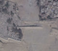
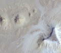
Admittedly, I had just watched a documentary on the mayans and i was a bit bored, so I started looking at the area between Edzná, Calakmul and Pomoná which are mayan sites. I looked there, because the terrain would make for a good connection between the ancient cities and there was nothing there.
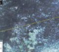
The Images from Google Earth seem to be from mid 2015, so the landscape cold have changed now, but there are lines visible in the vegetation that show a clear structure of 2km by 2km squares. The lines are broken from time to time by terrain deformation which could (imho) be a sign for their age.
Furthermore it is noteworthy that all lines show an unwavering straight line either north-south, west-east, or diagonally nw-se/sw-ne.
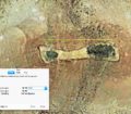
I have also uploaded a Google Earth folder in which i marked the clearly visible lines for you to review. Best to activate/deactivate the lines while looking, as they lie directly above the paths.
I know that a lot of speculation is involved, so I described the placemarker in th uploaded folder with some little arguments to show you that I have at least refected upon this prior to posting it.
Kind Regards,
Patrick


