Join me on Patreon and gain exclusive access to potential archaeological site locations and key research.
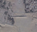
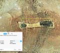
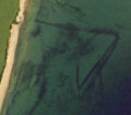
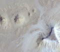
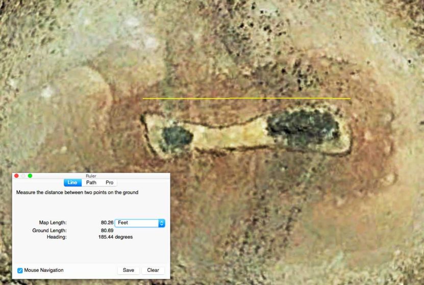
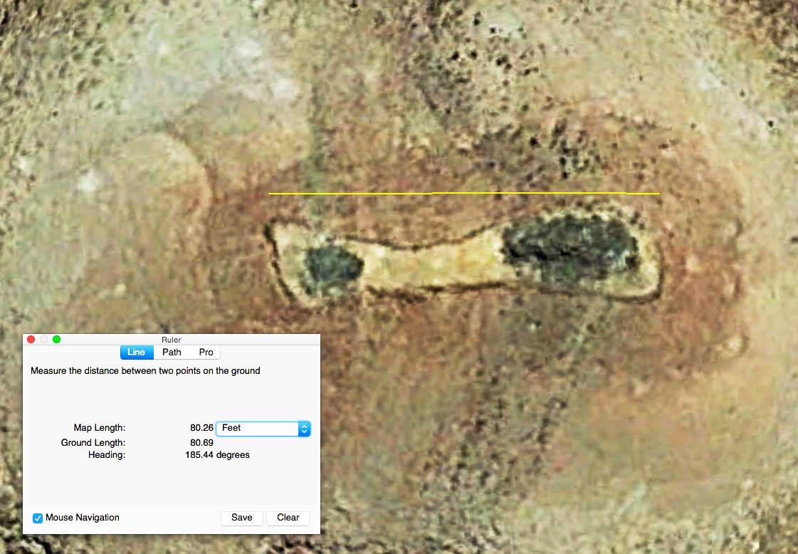
A very interesting site in the US that appears to be a large geoglyph or a man-made enclosure (undisclosed location). The geoglyph is perched precariously atop a mountain and sits approximately 740 feet above the surrounding landscape resembling the shape of a fish. The length is around 80 feet and the width is approximately 20 feet. The two darker black areas are a different material than the surrounding landscape and could indicate the material is a type of volcanic or dark-colored sediment that was either brought in or altered to appear dark. The surrounding landscape does consist of some darker colored sediment but this particular mountain is made of a different material. The darker sediment was either hauled in on purpose or the existing sediment was altered to appear dark. By altering the sediment I am suggesting there are indications this could be a smelter site as there are mine tailings dotting the surrounding landscape with campsites and wide-scale indications that mining was taking place in this vicinity.
-
 Unusual Geoglyph or Enclosure
 -
 Unusual Geoglyph or Enclosure
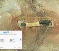
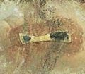
I’ve never really seen anything quite like this and I’m wondering if this could be a marker of some kind but of course, the elusive question is why go to all this trouble? USGS aerial imagery going back to the 1950s shows the site was intact back then so the site may indeed be quite old. I am really perplexed at the manpower necessary back in the old days to haul the rock up the steep mountainside to create this symbol. It stretches North to South with the “tail” being on the North and the “head” pointing to the South. It does appear there are trails going up the mountain and there may be caves alongside the cliff edge, perfect for placing anything valuable. It’s very obvious whoever made this wanted it to be seen from the air and this could also be an indicator of age although the tailings and the campsites look very primitive. There are no major roads going to this site and it is very isolated and off the beaten track, aka off the grid with the closest city around 10 miles away. Access to the site is fairly easy however, to tell more could compromise the location.
If anyone knows about this site, please leave a comment and let us know who could have created this. I would love to hear any ideas of what this site may be and if it could be a fish symbol we are seeing.