Join me on Patreon and gain exclusive access to potential archaeological site locations and key research.
Over the years, there have been many reports sent to me concerning lost cities or lost ruins in very strange locations. Many times sensor and jpeg artifacts have been misinterpreted as being signs of ancient cities on the sides of mountains or under lakes in remote places as seen in videos that were circulating on Youtube a few years back. Even though the possibility of misrepresentation or misinterpretation is typical, I always check into every location that I am sent just in case there is evidence for something extraordinary that has been overlooked from the ground. The use of satellite imagery is still in its infancy and with so much ground to cover it would take many years to search the entire visible surface of the globe for evidence of lost ancient history.
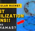
A very fascinating site that was reported to me by a tipster is the claim of a lost city under Lake Okeechobee in Florida. While proof is difficult to find at times due to the limitations of the information contained within the searchable databases like Google Earth, on rare occasions there can be a potential glimmer shine through. This case did happen to produce some unusual anomaly images of features present in the Lake Okeechobee imagery datasets.
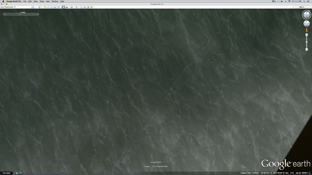
The interesting images were found using Google Earth and the time slider which allows the user to view historical imagery of a given site over a period of time. This feature is pretty neat, and I use it often to determine if an anomaly is something that is caused by modern or ancient activity. For example, if I view an anomaly site without using the historical slider then I slide the timer back in time a few years and notice the anomaly isn’t on the surface, that is an excellent indicator we are looking at modern activity.
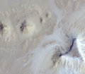
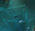
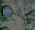
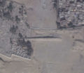
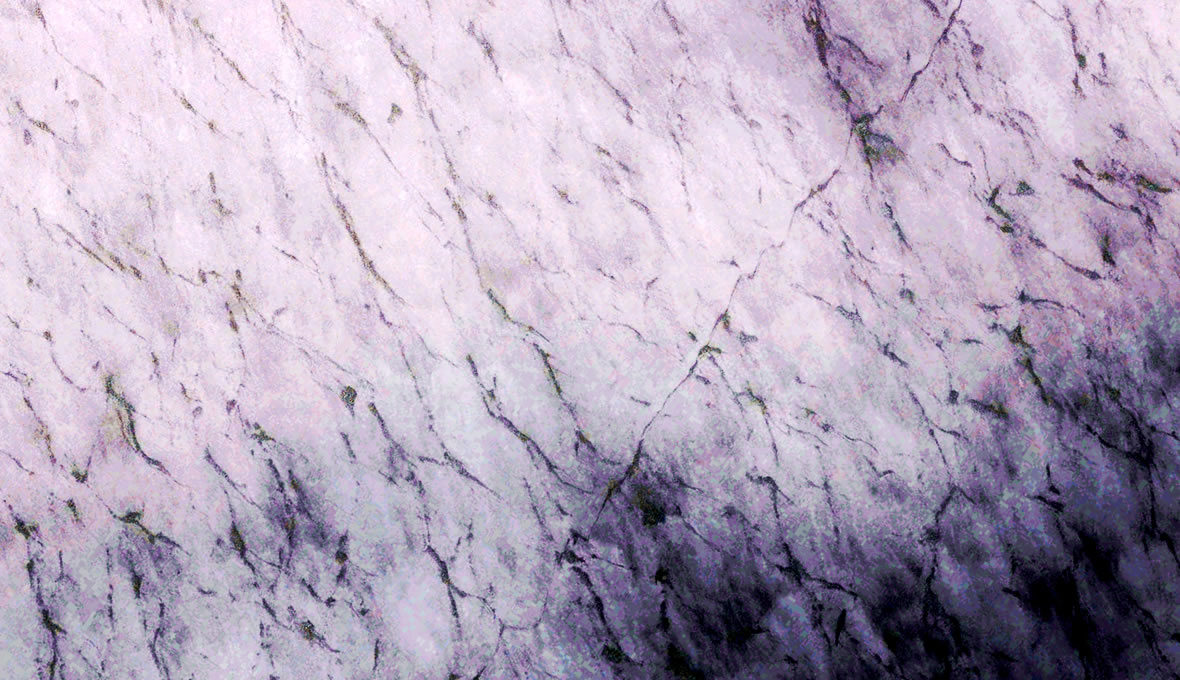
The image below is of the North Western portion of Lake Okeechobee taken in July of 2003. You can see what appears to be a faint line running from the left to the right of the image. This line is running North/South to the compass heading/orientation.
Lake Okeechobee Lost City?
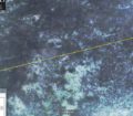
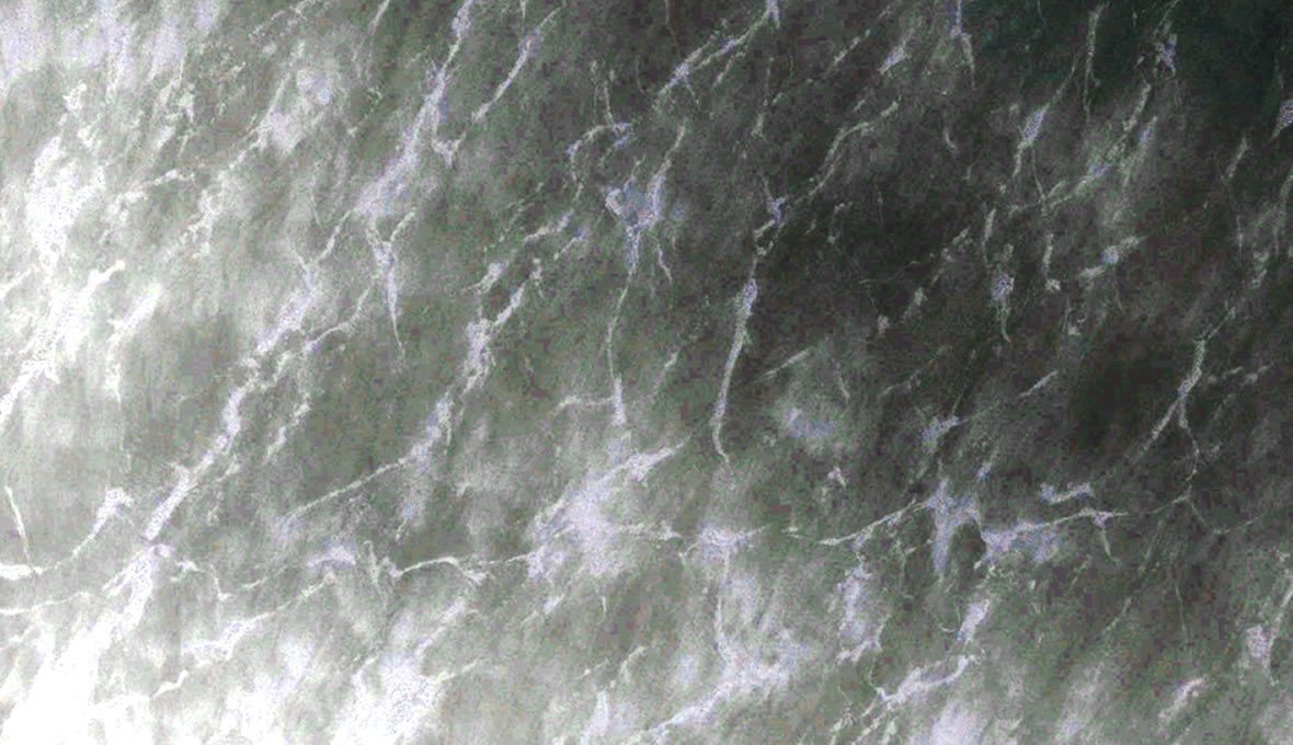
When zooming in closer it is interesting to see a series of patterns on the image and cell like features become visible:
Lake Okeechobee Lost City?
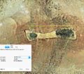
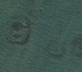
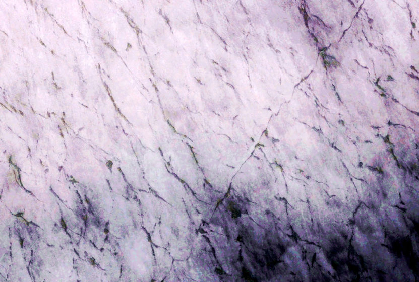
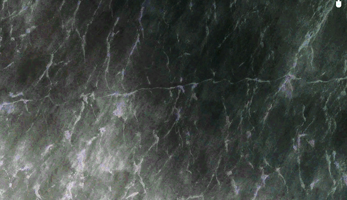
The image after a color enhancement has been applied using Photoshop:
Lake Okeechobee Lost City?
The image does seem to reveal a pattern emerging that could be under the surface of the water.
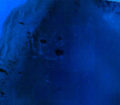
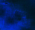
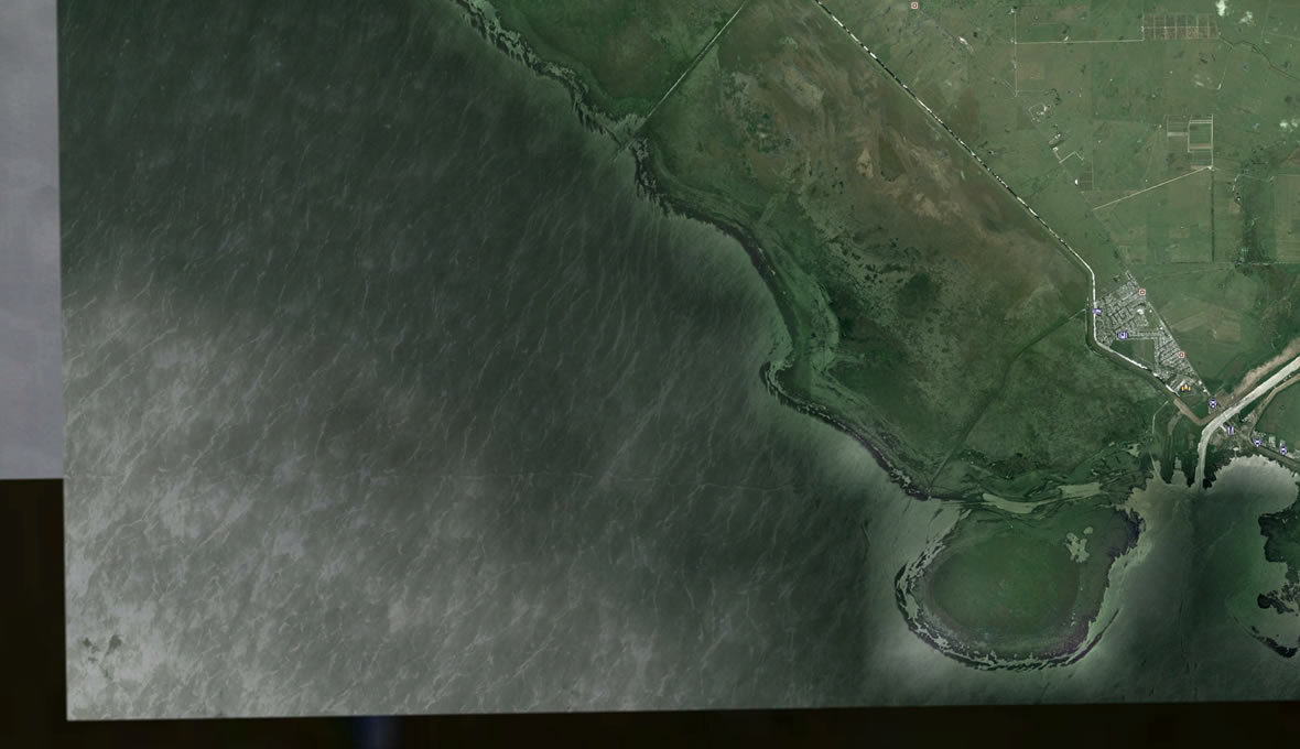
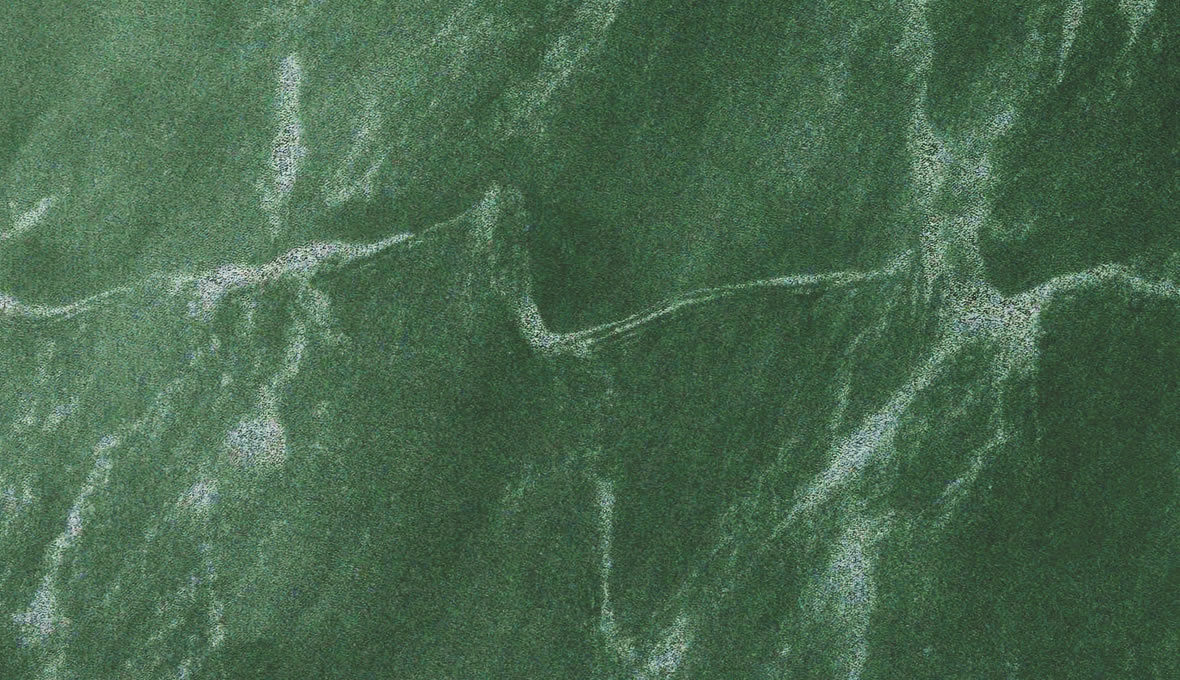
Another image seen below zoomed in a bit more with color enhancement applied.
Lake Okeechobee Lost City?
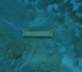
Another enhanced image:
Another close-up, enhanced image:
Lake Okeechobee Lost City?
The linear features vary in width from 60-125 feet.
Exactly what could these rectilinear features be?
- They do not appear to be waves, as waves of this size should not under normal conditions be present on the surface of a lake.
- It is possible the linear features have been created by boats making waves that have disrupted the subsurface sediment. If this is true, subsequent imagery at the same time of day and under similar conditions should reveal the linear features have changed as the sediment settles. An image of a water body at just the right time of day depending upon location like for example the Caribbean can be quite clear revealing the underwater surface very distinctly. Time of day is always key when trying to see through underwater imagery as the angle of light hitting the bottom changes continually.
- The lines could be a remnant of ancient activity and if that is the case whatever or whoever caused them left large signs as the lines vary in width from 60-125 feet.
- It is entirely possible that these features could have been ancient occupation activity yet this is highly unlikely due to the shape, size and lack of any archaeological precedence within the archaeological record. However, just because there is no record of such features does not mean it is not possible the features could be signs of ancient activity and it is always best to keep an open mind when there is very little evidence other than an image.
- It is also possible these features are some type of agricultural sign or ancient land terraforming features like hedges or fortifications. Again the search for precedence is key but should not be the driving force to dismiss or arrive at premature conclusions.
- What we are seeing is a part of the natural landscape that exists under Lake Okeechobee and has been created as a result of geological forces. A very boring and normal explanation but one that must not be ruled out or dismissed.
- The features are not present on the underwater landscape and are just a result of imaging phenomenon or an imaging anomaly, and this begs the question are they actually present on the underwater landscape?
The above are my logical thoughts on what could be responsible for causing such features present on a satellite image. Those who are wanting to delve further and feel this is a great mystery may want to use LIDAR to determine precisely what could exist under the lake or infrared imagery offered by Digital Globe to arrive at firm conclusions.
After searching for and researching the locations of lost cities for many years, it would be very close-minded to dismiss the numerous accounts and information that have been relayed to me about strange, archaeological anomalies being found all over Florida. These reports are worthy of some mention and acknowledgment.
Reports from Florida:
- Some modern canals are actually ancient canals and have been modified for modern use.
- Reports of clear domed buildings being seen by pilots in the Straits of Florida yet I have never found any proof of such structures. Many of these reports were during the 1970s and led to a movement of people from all walks of life visiting Florida in search of these domed buildings.
- Reports and sightings of ancient walls throughout the Florida peninsula. The reports indicate the walls were here when this country was very young and first populated by early farmers. The walls were made of stone and ran for many, many miles all over Florida. I have yet to find proof of such stone walls, and I am hoping that if someone has proof, they will please use the contact form on this site and tell me your story.
- Reports of staircases and building ruins in the Florida Everglades and throughout marshy regions of Florida. The reports state the ruins are made of white, marble-like material or a type of limestone.
- Reports that some of the offshore islands around the Keys were made by humans as barriers to protect the land from rising water. Barriers of this size would be one heck of a feat even for modern construction.
- Reports that many of the retaining walls made along the beaches of Florida were made using white stones from cities of a lost civilization.
After all these years of searching, here is what I have found in Florida and within the Everglades areas.
- Anomalous linear features that are reminiscent of Mayan sacbe type roads with evidence whatever the lines were made of could be leaching into the surrounding material as it erodes. Limestone is an ancient building material that when weathered over time can disrupt the natural foliage revealing locations of stone ruins.
- Evidence of circular raised areas similar to sites on the Yucatan Peninsula and in the Bahamas that are connected by linear features that may be ancient roads or possibly canals. I have theorized the circular raised features are mounds where ruins may exist similar to sites of this type all over the Middle East.
- Evidence of canals that are possibly of an ancient origin.
- Evidence of mound features that may have been created by ancient man. There are many known sites such as the mounds at Crystal River where the mounds are made out of discarded shells.
The images of strange anomalies on Google Earth under Lake Okeechobee may not be the ultimate proof a city or a lost civilization exists in Florida, yet the imagery is very compelling and suggests there may be something out of the ordinary going on. I look forward to a time when scientists can be openly curious and investigate sites like these without fear of ridicule or backlash. Until that time, I will continue to gather the evidence and leave the breadcrumbs for future generations to follow.
If you know or think you know what these features could be, please use the contact us form or leave a comment below.