
Join me on Patreon and gain exclusive access to potential archaeological site locations and key research.
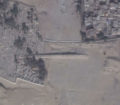
Among the many enigmatic and mysterious structures that can be found at the Giza Plateau, The Wall of the Crow (sometimes referred to as the Wall of the Crown) remains one of the most elusive and enigmatic topics of interest. It is one of the oldest structures, according to archaeologists, and the megalithic stone over the gateway was cleared in modern times and is one of the largest stones at Giza. A truly massive construct! The wall is easily identified from satellite at the following GPS coordinates: 29°58’19.79″N, 31° 8’24.35″E.
The size of the gateway stone can be seen in this 1840s sketch.
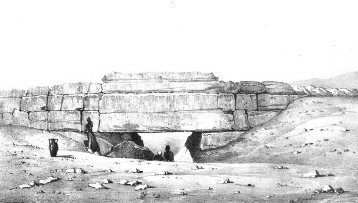
Wall of the Crow
The wall is composed of large masonry blocks of limestone that are gigantic in places, and the purpose of the wall has yet to be discovered. The wall is 656 feet long (200 meters), 32.8 feet high (10 meters) and 32.8 feet (10 meters) thick at the bottom of the structure.
Archaeologists have dated it to the 4th Dynasty although there are suspicions by researchers the wall is much older, possibly dating to the time of the Sphinx. Archaeologists have theorized it was an unfinished, undressed wall that was never completed by the Egyptians. The function of the wall is still unknown according to academia, and the cyclopean effort that went into creating this wall hints that it was for a significant purpose. Sand still covers most of the structure, and it has been estimated that over 2/3 of the wall is still underground suggesting that if all the sand were cleared this wall would stand around 45 feet tall almost the height of a three-story modern building!
The theories for the wall include a boundary between the “worker’s camp” found nearby and a dam to deflect floodwaters from an adjacent stream. It has also been theorized the local residents considered the area around the Wall of the Crow as sacred ground with burials extending all around with a cemetery for sheikhs built north of the west end of the wall. This cemetery is considered one of the first Muslim grave areas found at Giza.
The pyramids and temples on the plateau are very precisely aligned with the cardinal directions, the Wall of the Crow is aligned five degrees north of due East and five degrees south of due West which is a very peculiar detail. This detail may hint that the wall was a causeway leading to the Nile as it does seem to mimic the angle of the ancient causeway fragment due East of the Great Pyramid. If it was a causeway, where is the structure it was leading to as it seems to lead directly into the Muslim cemetery?
Or, could there be something else we have missed that is hidden in plain site?
Let’s examine some interesting clues that might indicate there is much more buried under the sand at Giza waiting to be uncovered.
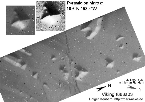
As a young adult, I was fascinated with the work of Richard Hoagland whose work became popular overnight as he drew attention to the “Face on Mars” that has since been debunked and/or heavily covered over by subsequent missions to Mars. Regardless of whether the formations on Mars are natural or made by intelligent life, this is what first generated my spark in searching for lost ruins on Earth from space. It also caused many other people to search the newly de-classified Viking image databases that were made available online for signs of oddities. It seemed logical if the Mars anomalists could search the planet, why couldn’t we find lost ruins here on Earth too? As I began researching Mars along with others in the late 90s, I crossed paths with Carl Sagan and formations he had spoken of several times in the Elysium area of Mars. They were captioned, “The Pyramids of Elysium” in his book “Cosmos” and he even suggests that although the hills could be an ancient eroded shape that had been sandblasted for centuries, they needed to be viewed from nearby to make a full determination of their origins. I interpreted his interest and statements that we just wouldn’t know for sure if the features were artificially made or natural until we go there and analyse them from the ground. This is true of many satellite image anomalies in general as I know all too well
As I began researching Mars along with others in the late 90s, I crossed paths with Carl Sagan and formations he had spoken of several times in the Elysium area of Mars. They were captioned, “The Pyramids of Elysium” in his book “Cosmos” and he even suggests that although the hills could be an ancient eroded shape that had been sandblasted for centuries, they needed to be viewed from nearby to make a full determination of their origins. I interpreted his interest and statements that we just wouldn’t know for sure if the features were artificially made or natural until we go there and analyse them from the ground. This is true of many satellite image anomalies in general as I know all too well…
Needless to say, I spent more than a few hours scanning the Viking images just for fun, and I did find something that fascinated me greatly about the planet Mars and a visual relationship to the Giza plateau.
Before we visit this oddity, we must look at the meaning of the name “Cairo” that has been pointed out by countless other researchers before me. The word “Cairo” is derived from the Arabic name “Al Qahira” which in turn is derived from the Arabic name for the planet Mars, “Al Najm Al Qahir”. Many researchers attribute this linguistic relationship to the planet Mars because the planet was said to be rising on the day the city was founded in 972 C.E.
Just an interesting coincidence?
Whether there is more to the story on the relationship between the word Cairo and the planet Mars remains to be seen. However, from a visual perspective, the coincidence is more than a little interesting, yet is it just a coincidence? Ah, more questions but these questions could be answered easily by inspecting one particular site at the Giza Plateau, the mound called Gebel Ghibli. First let’s examine the eerie, visual coincidence of the correlation to the massive volcanoes on Mars and the Giza plateau that first caught my eye and my imagination.
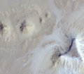
Let’s see an image of the Tharsis region of Mars, home of the Olympus Mons volcano which is estimated to be the largest known volcano in our solar system and is three times taller than Mount Everest. Pictured below: Olympus Mons and three more volcanos of the region, Ascraeus Mons, Pavonis Mons and Arsia Mons.
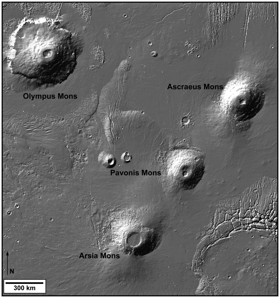
Tharsis region of Mars
At first glance, the placement of the volcanos in the image does look familiar, almost uncannily so. Then, when we view an image of the Giza plateau, it becomes very apparent there is a visual similarity.
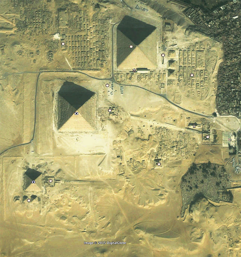
Giza Aerial Wall of the Crow
Side by side image for comparison:
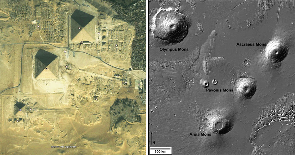
Mars Giza Comparison Image
Now, back to the question at hand, is this just an interesting, fun coincidence?
To answer some of the questions, let’s overlay the Tharsis image with the image of the Giza plateau to see how accurate the alignment between the two images really is. To do this, you must either flip the Giza plateau image upside down or the Mars image upside down. For this example, I have flipped the Mars image upside down and overlaid it with the Giza image as seen below. The scale of the Mars image was reduced, and the overlay can be seen below with the outline of the volcanos in red.
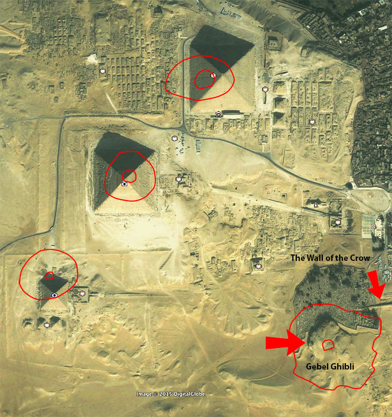
Overlay of Tharsis region of Mars with the Pyramids at Giza.
The outline of the Mars Tharsis volcanos can be seen in red superimposed over the Giza plateau, and the circles are the calderas of the volcanos. The alignment although not perfect, is still more precise than what I had hoped. It can be seen very easily that the Olympus Mons volcano is on top of an existing formation on the plateau, a mound called Gebel Ghibli and the pyramids line up with the other Tharsis volcanos.
It also begs the question, were the Giza pyramids really aligned to Orion’s belt after all, or could they have been aligned to the volcanos on Mars? How could something like this even be possible? The answer seems to be located in the vicinity of Gebel Ghibli. If there is something at this site then without a question what we are seeing is a direct correlation between Mars and the pyramids. There, I said it. I can hear the ancient alien theorists cheering in the background as I write this yet it does make you wonder, could Gebel Ghibli be a lost pyramid on the Giza plateau with a direct, visual and linguistic relationship to the planet Mars?
Is this just a lucky coincidence or is this mound something quite extraordinary hidden in plain site on the Giza plateau?
To begin to understand exactly if this is a coincidence or if there is more to this eerie connection I decided to examine the term “Gebel Ghibli” linguistically to see if there was any clue or hint to something hidden under this hill. The term “Gebel” means mount or hill while “Gibli” means south and is derived from the Arabic term “qiblah” which means “direction of prayer” towards which Muslims pray to Mecca. So, we can interpret the term as denoting the southern hill which means “direction of prayer”.
Another interesting bit of information is the hill has several names, not just one. Another variation of the name is “Gebel Gibli Ahram” which means the “southern pyramid mount”! Can it get any clearer than this?
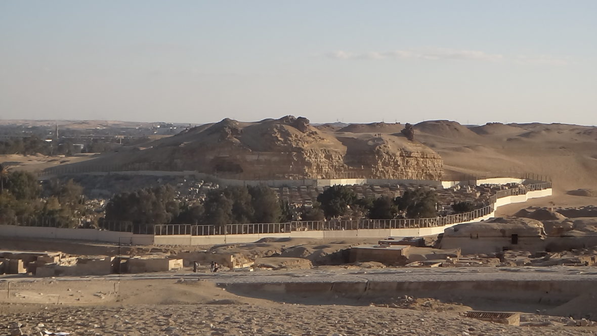
Gebel Ghibli from the ground.
I have also speculated in the past with this research that the significance of the Gebel Ghibli hill is the possibility this was the mound of first creation from the ancient Egyptian creation myths which would be a very sacred site to the ancient Egyptians. On my very first trip to Egypt, we took a trek around the plateau on camels, and I made sure the camel guide took us to the top of Gebel Ghibli and all around the bottom of the mound. To my delight, although it seemed a bit treacherous at the time perched atop a camel, one could see the whole plateau from the top of the mound. This seemed like the perfect spot for the builders to plan and observe the construction of the pyramids!
Was this the mound of first creation or a previously unknown pyramid hidden in plain site on the Giza plateau?
One thing I noticed to my amazement was an area of the hill that looked like someone had been digging into the side of it as can be seen in the image below. Did someone else think this mound was possibly very significant?
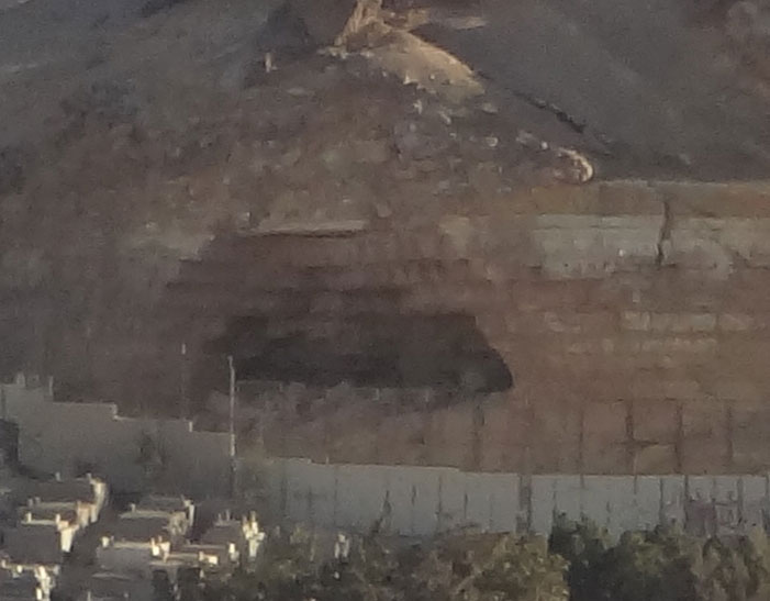
Gebel Dig site.
Of course, the question still needs to be answered fully, is this connection with Mars just a coincidence or is there something significant at the mound called Gebel Ghibli?
Are we seeing the remains of a lost pyramid at Giza?
I’ve often thought logically that it is possible the remains of an ancient civilization over 10,000 years, or older may be indistinguishable from natural formations. After the water has eroded and the winds of time have had their effect, what would stone ruins look like after existing against the elements for long periods of time, particularly mud brick and limestone ruins? Could there be ruins all around us yet they have become undetectable due to their age and natural appearance? I tend to agree this is a logical and likely scenario and one I have witnessed at the site called “Abu Sidhum” in Egypt. Does this mean every hill or mound is a ruin? NO, (!) but although appearing natural on the ground the birds eye view has and can reveal a different, hidden perspective. It is also interesting to think about the possibility that the original creators did not want the sites to appear man made from the ground view in the future. Perhaps they wanted these sites to remain hidden as would be the case if they are tombs or sites that were never meant to be opened in the first place.
I look forward to the day sophisticated GPR scanning technology can be used at many of the areas shown at this website! As is often the case with work like this, many questions simply remain unanswered, and the hope relies on future generations to follow the breadcrumbs and see into the past perhaps with even greater clarity than we could even begin to imagine is possible today.
What other structures could lay hidden on the Giza plateau?
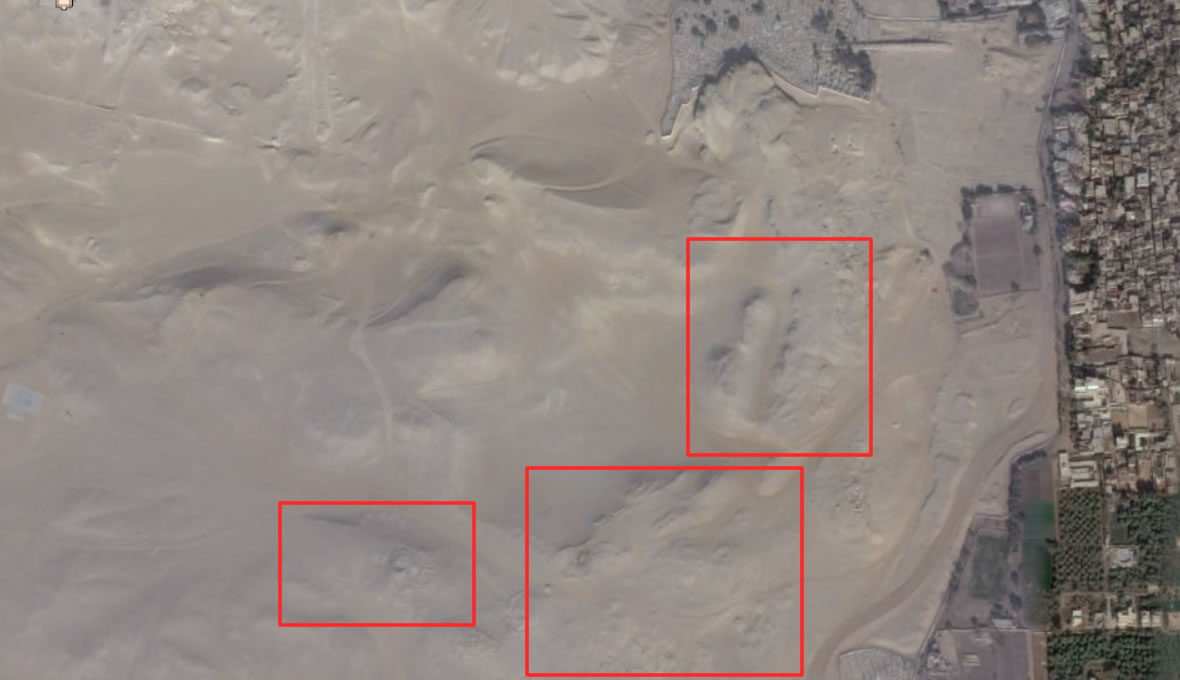
Other areas at Giza that need excavation.
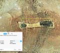
This is an image of a structure that hasn’t even been excavated seen from satellite imagery:
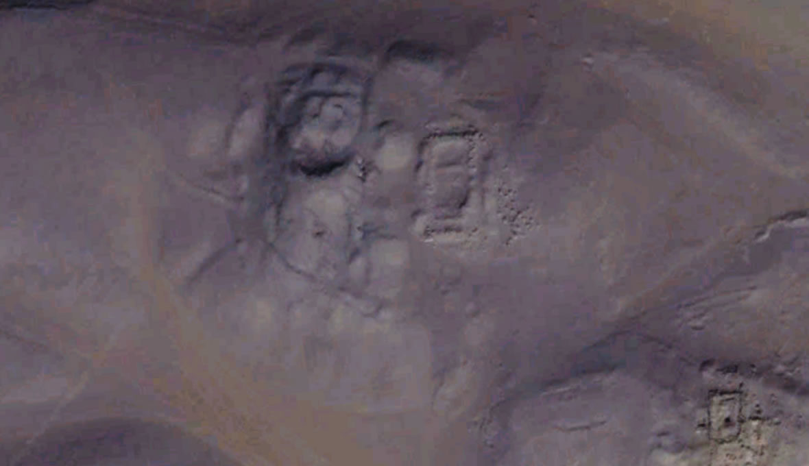
An area at the Giza plateau that needs to be excavated.
Is Gebel Ghibli Giza’s Lost Pyramid Site?
For all of you interested in the mysteries at Giza, the mound Gebel Ghibli may reveal long lost secrets if it can ever be studied and examined for hidden cavities and signs of artificiality. On the outside, it does appear to be just a regular old hill that can be seen very good from the Sphinx, yet I can’t help but feel there is way more here than meets the eye. We need to ask more questions and explore sites like these in detail while always taking into consideration that we do not have all the answers. While science is not infallible by any means, it can be very unforgiving as it often takes years and decades to modify traditional theories with new and more accurate data. I would personally like to get to the answers in my lifetime, and I will continue to search and question established theories and traditionalism with inquisitiveness and innovation.
This article is part of an image study and inquiry that was published on the Satellite Discoveries website in 1998.
If you have information you would like to share about this site, please leave a comment below.








Gizeh-Egypt: Image of human face in aerial photo STERN, near the
Sphinx of Gizeh, today excaved!
People of ancient Egypt at last today confirm his firm belief in another life.
Sunlight always contributes in egyptian gods designs.
http://webspace.webring.com/people/or/ramonetriu/caradegiza.html
http://youtu.be/8tgqNrCDI_s